Interactive Civil War maps and digital storytelling tools

It’s always a great day when I get to spend time with people who love talking history. That was my day yesterday. Strategies, resources, what works, what doesn’t.
Good times.
Part of the time involved what I call “play time.” Most teachers have a limited time during a typical day to just play around – browse for resources, chat about scope and sequence, argue about Kennedy’s response to Soviet missiles in Cuba.
You know. The part of the day when real professional learning happens.
It was during this period of sharing and browsing that a teacher found an awesome site that she passed on to me.
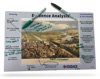
Titled Battlefields of the Civil War and created by the smart people over at ERSI, the site highlights battles in chronological order on a zoomable map. You can narrow the time range as the tool animates the battles on the base map. You can also select the map background – going with a standard geo view, a sat view, or my favorite, an 1862 version of the US.
You can search for specific battles. Zoom in to detailed areas – the area around Richmond or Atlanta, for example.
One great feature is that you can go directly from the map view to the sweet the Civil War Trust site. You’ll get some sweet detailed battle maps, detailed overview of that battle, photos, and links to other sites on the battle.
I like how you can provide students a wide view of the war but can zoom in tight to a specific geographic place. The site does a great job of helping kids develop a connection between events and place. And the connection with the Civil War Trust can help provide a deeper understanding of specific battles.
I’ve embedded a quick video of the site. I would use this sort of view to provide a hook to my Civil War unit. Or to force kids to think about why battles happened in certain areas rather than others. Maybe stop the animation half way through and have students predict where the next series of battles will happen and explain why.
Two other cool pieces to this. The Civil War Battlefields is part of a larger piece by ERSI called StoryMaps. There are some 70-80 other maps that you can browse through, some more helpful to social studies teachers than others. But some good stuff there.
Second cool piece is that ERSI has created a series of StoryMap templates that you can use to create your own goodies. Have kids use this to create geo-based assessments and products. Be sure to check out the right-hand side of the StoryMaps for other handy stuff – such as this helpful PDF that outlines Best Practices for creating quality StoryMaps.
Just another example of why playing at work is a good idea.
Now if we could just get that nap policy approved.


Trackbacks & Pingbacks