CIA Factbook + Google Earth = kmlfactbook
I’m sure most of you, especially geography teachers, use the CIA Factbook all the time. It’s such a huge database of info and geo goodies. I’m also sure that may of you have found great ways to incorporate Google Earth in your instruction.
But wouldn’t it be cool if you could combine the two? CIA’s data displayed visually in Google Earth?
How about a tool with a Google Earth view with not just data from the CIA Factbook but from the United Nations and the World Resources Institute EarthTrends as well? How about the ability to download that visual in KML format and edit in your own Google Earth software? How about 2D and 3D options? Now that would be cool.
Cool has arrived.
kmlfactbook is an incredible tool that lets you and your kids “see” data in ways that haven’t been available before. The site integrates all sorts of data into the Google Earth software.

And kmlfactbook is pretty easy to use. Browse the left part of the screen to select which data-set to display. Select which data-base to use from the top-left drop-down menu. Below the data-base drop-down select the data category – People, Economy, Geography, etc – then select the particular data-table that you want to work with.
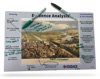
You can also select which type of visualization – 2D, 3D or charts – to create from the data. This screenshot shows a 3D view documenting HIV rates:

Yeah . . . I know. Pretty cool.